Butetown lies at the head of the Rhymney Valley in South Wales, four miles east of Merthyr Tydfil and about a minute from the A465 Heads of the Valleys road. Until re-organisation in 1974 it was separated from Rhymney, its social and economic focus, by the old council boundaries. This led to neglect. Its rural setting on the moors above Rhymney is not typical of industrial housing in South Wales and its isolated position caused it to become known locally as the village.
Butetown was originally part of a more ambitious scheme called Newtown (Drenewydd) which never developed beyond the three terraces extant today. Butetown is built on Gwaun y Mynach (Monks Moorland) which formed part of the lease from the Marquis of Bute to the Bute Iron Works in 1825 and from which it gets its name. The date of construction is not certain and it may have been part of the nearby Union Iron Works which started operation in 1801. Richard Johnson, the manager of these works in 1802, is reputed to have built Butetown. He was a far sighted man and such a scheme would be in keeping with his plans but many dispute that Butetown was built that early.
Coal, iron-ore and limestone appeared abundantly in outcrops nearby. With water also plentiful, the area was ideally situated for the development of iron smelting works.
It is known that by 1825 a road pattern was already laid out in Butetown. It is therefore assumed that the houses were built shortly after and were all erected by the 1830’s. The road pattern exhibits a regimented form suggesting that the roads were the start of a much larger town and evidence exists of foundations for a further terrace to the south. The building of Butetown was prevented from reaching the scale envisaged by Johnson by the exhaustion of the iron-ore of the early shallow workings around the ‘Upper Furnace’ and by a limited slump in 1830-32.
The houses at Butetown are built to a very high standard for their purpose. According to one authority their ‘design was probably based on a planned village at Lowther, Cumbria, which was begun in 1765 by the architect James Adam’.
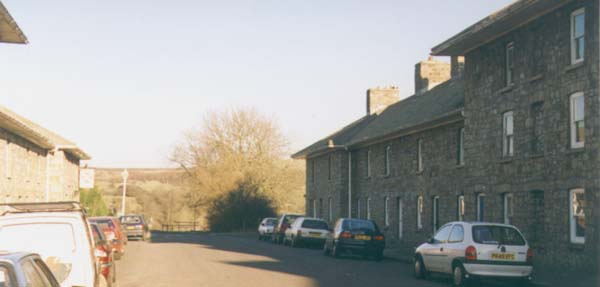
They are constructed of millstone grit blocks collected locally. These are random coursed with a mortar of lime and ashes. There are wide overhanging eaves and the roofs are made of stone tiles laid to a shallow pitch with hipped junctions.
Roads were constructed from the east of the hamlet to the old furnace of Upper Rhymney and adjoining routes to Abergavenny and Tredegar. Western access to the settlement links with routes south to Rhymney and north to Merthyr. In 1858 the joint concern of the Rhymney Railway Company and the London Western Railway Company constructed a railway through the settlement and a station at Rhymney Bridge. The foundation of the Rhymney Iron Company in 1835 (taking in all iron works at Rhymney) gave rise to great local activity and a rapid increase in the population of Rhymney.
By 1891 all the local furnaces were demolished and from that time onwards, the Rhymney Iron Company carried on its coal and brewery concerns only. During the 20th century, particularly during the 1920’s and 1930’s this area saw a rapid decline typical of many Welsh Valley areas.
The historic importance of Butetown is without question. It features in Jeremy Lowe’s study (of the Welsh School of Architecture, UWIST, Cardiff) “Welsh Industrial Workers Housing 1775 – 1875” as an early industrial settlement of exceptional significance. A key feature of Butetown is that it is totally planned, which is unusual for an early industrial settlement. Every aspect of the development forms part of an interconnected whole.
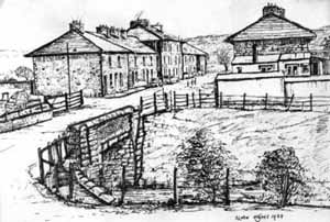
The conservation area consists of three terraced rows laid out in a grid iron pattern with Collins Row to the north followed by Middle and Lower Rows to the south respectively. Each terrace consists of 16 dwellings having a central three storey pavilion of four dwellings flanked by four more and terminated by two dwellings to form end pavilion blocks. However, two of the dwellings in Collins Row have been demolished leaving a total of 46.
The eastern end of Middle Bow is terminated by the Windsor Arms pub and between Collin’s and Middle Rows lies the small church dedicated to St, Aiden, Both titles have Bute family associations. The cellar dwellings of Lower Row are some, if not the only, remaining ones in South Wales. These vaulted rooms open to the south and consist of a living room with a hob fire and bread oven, and a bedroom beyond.
The form of Butetown has changed very little from when it was constructed. The three rows of houses and the Windsor Arms public house form a group and were listed under section 54 of the 1971 Town and Country Planning Act, as grade II buildings of special architectural or historic interest on 24th. July 1973. The Conservation Area was designated on 20th. October 1972 at the same time as being declared a General Improvement Area.
You may have spotted from the mixed styles that this is a reworked combination of existing documents describing Butetown. Oh the wonders of OCR…

The main street of Butetown with Middle Row to the left and Lower Row to the right. You can see the sign for the Windsor Arms.

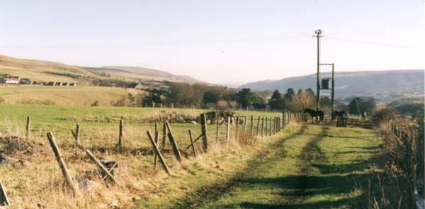
The view down the Rhymney Valley.

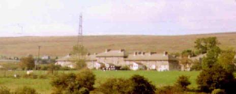
Butetown on its moor, as seen from Rhymney
